

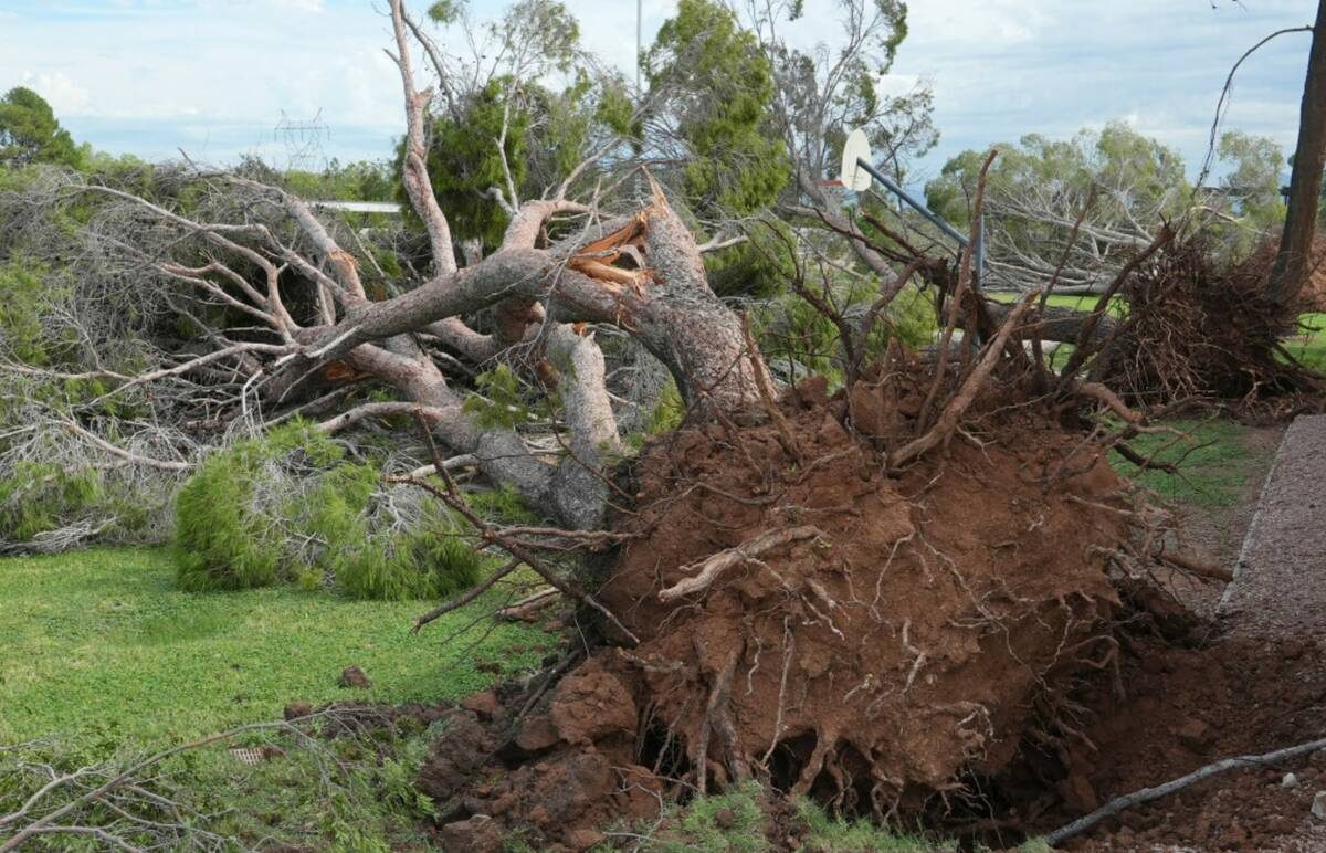
A rare severe storm pounded northern and central Arizona overnight Tuesday into Wednesday, dropping hail up to 2 to 3 inches in diameter and producing damaging wind gusts. The National Weather Service issued multiple warnings, including tornado watches for the first time in the state since October 2010, urging residents to seek shelter and stay away from windows. Hail shattered windows, dented vehicles and damaged roofs across the region.
In Flagstaff, strong winds toppled large ponderosa pines over 30 feet tall in the Coconino National Forest and knocked down trees onto walls and carports in the city and in Mesa. Ryan Bernhart, a National Weather Service meteorologist in Flagstaff, said warm, moist air moving north from the California coast combined with changing winds to create the spinning conditions that can produce tornadoes. "This is very unusual for this area at this time of the year," Bernhart said.
The primary threat for the Phoenix metro area is heavy rainfall and flash flooding Wednesday night and Thursday morning, according to Mark O'Malley, a meteorologist at the National Weather Service in Phoenix. The same Pacific storm system is expected to bring showers to Southern Nevada on Thursday, less than two weeks after the remnants of Tropical Storm Rachel delivered record rainfall to the Las Vegas Valley.
Sam Meltzer, a meteorologist at the National Weather Service in Las Vegas, said the valley is forecast to receive less than a quarter-inch of rain. Rain chances rise to 70 percent after sunrise Thursday, decrease to 50 percent by afternoon, and skies should clear by evening.
Sources: Las Vegas Review-Journal
Original reporting: Las Vegas Review-Journal →



 English (US)·