.png)
 5 months ago
22
5 months ago
22
Darren Bett
Lead Weather Presenter

 PA Media
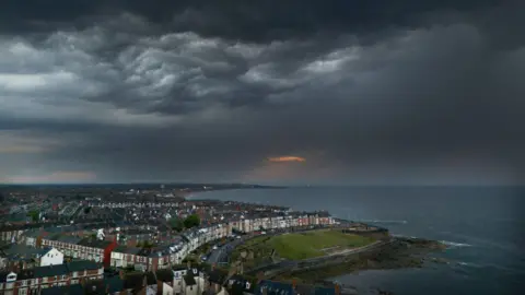
Storm clouds gathered above Whitley Bay in North Tyneside on Saturday evening following high temperatures across the UK in recent days
Wind and rain are drifting across the UK, bringing more mild temperatures following a wave of extreme heat, the Met Office said.
It forecast Sunday would feel fresher for most, with sun and scattered showers, and that a weather front was due to push in from the west over Monday evening, bringing a wet end to the weekend.
On Saturday, the UK experienced its hottest day of the year, with temperatures of 33.2C (91.8F) recorded in Charlwood, near Gatwick.
An amber heat health alert covering England, first issued by the UK Health Security Agency (UKHSA) on Thursday, remains in place until 09:00 BST Monday.
An amber alert warns health and social care services are likely to be "significantly" affected by the high temperatures, including through an increase in demand and a rise in deaths particularly among those aged 65 or over or with health conditions.
After the hottest weather of the year on Saturday and some late thunderstorms, Sunday has felt very different. Temperatures are lower and the humidity has dropped.
Temperatures have reached around 27C in southeast England but more cloud is streaming over the UK on a brisk westerly wind that is bringing showers or longer spells of rain to many areas.
The week ahead will remain more unsettled with some rain at times, together with some sunshine. It will still be cooler and fresher than it has been but there will be some very warm weather at times in eastern parts of England.
Monday will see fewer showers and more sunshine. There could be some light and patchy rain on Tuesday.
But later on Wednesday and Wednesday night, muggy air from France means there is the risk of heavy rain and thunderstorms.
This should clear on Thursday with more wet and windy weather for northern areas to end the week with warmth further south.
 Reuters
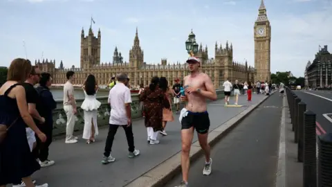
Temperatures reached more than 30C in London on Saturday
During Saturday's extreme heat, passengers on trains in south London had to evacuate after a fault on a train near Loughborough Junction brought all services in the area to a halt.
"Without power and air conditioning on such a hot day, we pulled all resources from across Sussex and Kent to get personnel on site to safely evacuate passengers as quickly as possible along the track," Thameslink and National Rail said in a statement.
Suffolk was the first area during the recent set of higher temperatures to reach the threshold for a heatwave when it recorded temperatures of over 27C for the third day on Thursday.
For a heatwave to be declared by the Met Office, a threshold temperature needs to be met for at least three consecutive days.
The threshold varies from 25C across the north and west of the UK, to 28C in parts of England.
 ejwwest/Weather Watchers
Seahouses, Northumberland was one area of the UK that saw stormy weather overnight


 English (US) ·