.png)
 2 months ago
12
2 months ago
12
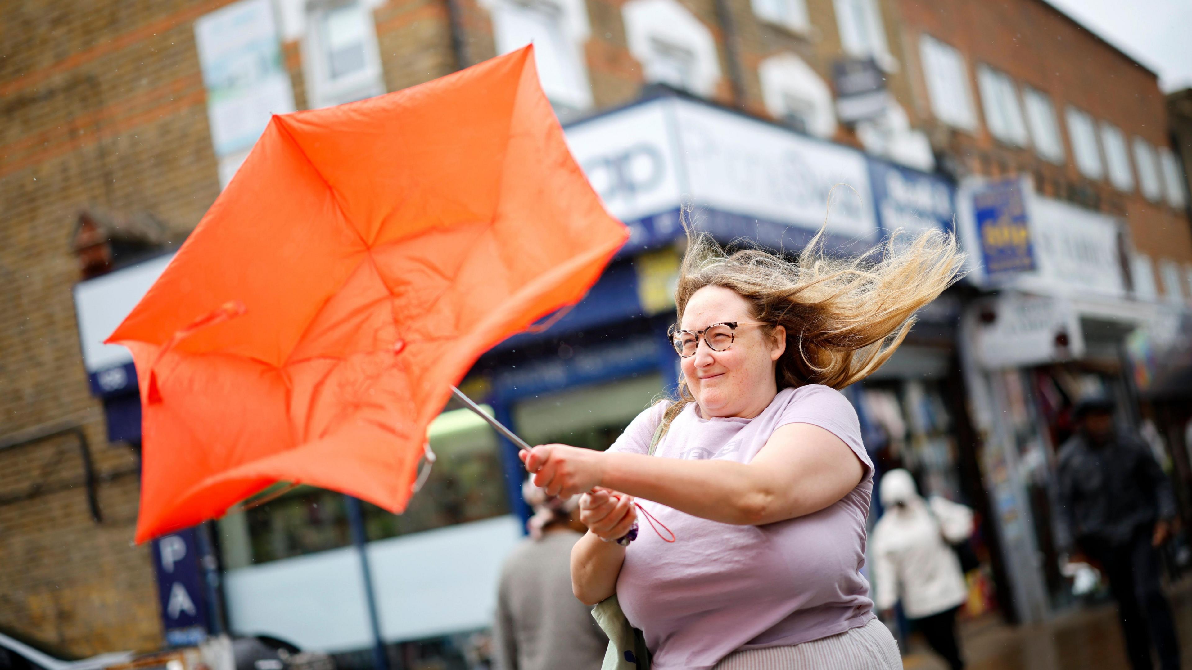 Image source, Tolga Akmen/EPA/Shutterstock
ByBen Rich
Lead Weather Presenter
A Met Office yellow warning for strong winds is in force across the southern half of the UK on Monday as an area of low pressure passes close by.
A gust of 78mph (125km/h) was recorded at Needles, Isle of Wight, on Sunday night with widespread windy conditions expected to continue until the evening.
This is causing some travel disruption including the closure of the M48 Severn Bridge.
However - contrary to some media reports - this weather system is not a named storm.
Yellow wind warning for England and Wales
The Met Office warning covers all of Wales and most of England - away from the far north - and is valid until 1800 on Monday.
Wind gusts of 45-55mph (72-89km/h) will continue to affect many inland areas with gusts of 60-70mph (97-113km/h) likely around exposed coasts and over hills.
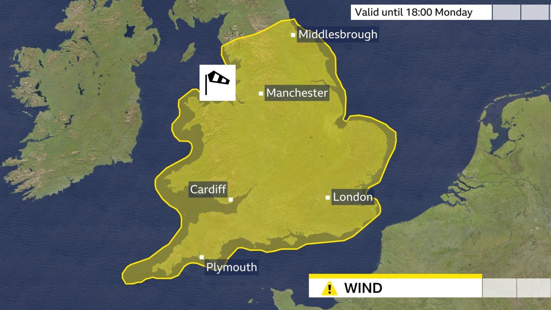
There is a risk of disruption on the roads and at airports, while Network Rail, external is warning of possible delays on railways.
Large waves are expected around the coasts and some power cuts are possible.
The weather is expected to calm down during Monday evening as the strongest winds begin to ease.
Heavy rain also features with downpours across many northern and western parts of the UK.
Why is this not a named storm?
Some media reports, as well as posts on social media, are suggesting that this is Storm Amy - the first named storm of the UK season.
That is not the case.
The Met Office names storms in conjunction with the Irish and Dutch weather services based on how significant the impacts are forecast to be.
A storm is typically named if it is expected to be bad enough to warrant an amber or red weather warning, and that looks very unlikely this time.
When this area of low pressure first appeared on weather charts several days ago it did seem possible that it could be strong enough to be named.
However, as the forecast became firmer it looked less and less likely that there would be significant impacts.
Storm Amy is going to keep us waiting a while longer.
Will there be a September storm?
The UK had its hottest summer on record but there is no doubt that the start of meteorological autumn has brought a big change.
The jet stream has dropped southwards sending wind and rain-bearing weather systems on a beeline for our shores.
That has made it a wet September so far, especially in southern and western parts of the country where some places have already recorded more than their average rainfall for the whole month.
However, there is no suggestion that hosepipe bans and water restrictions will be lifted yet.
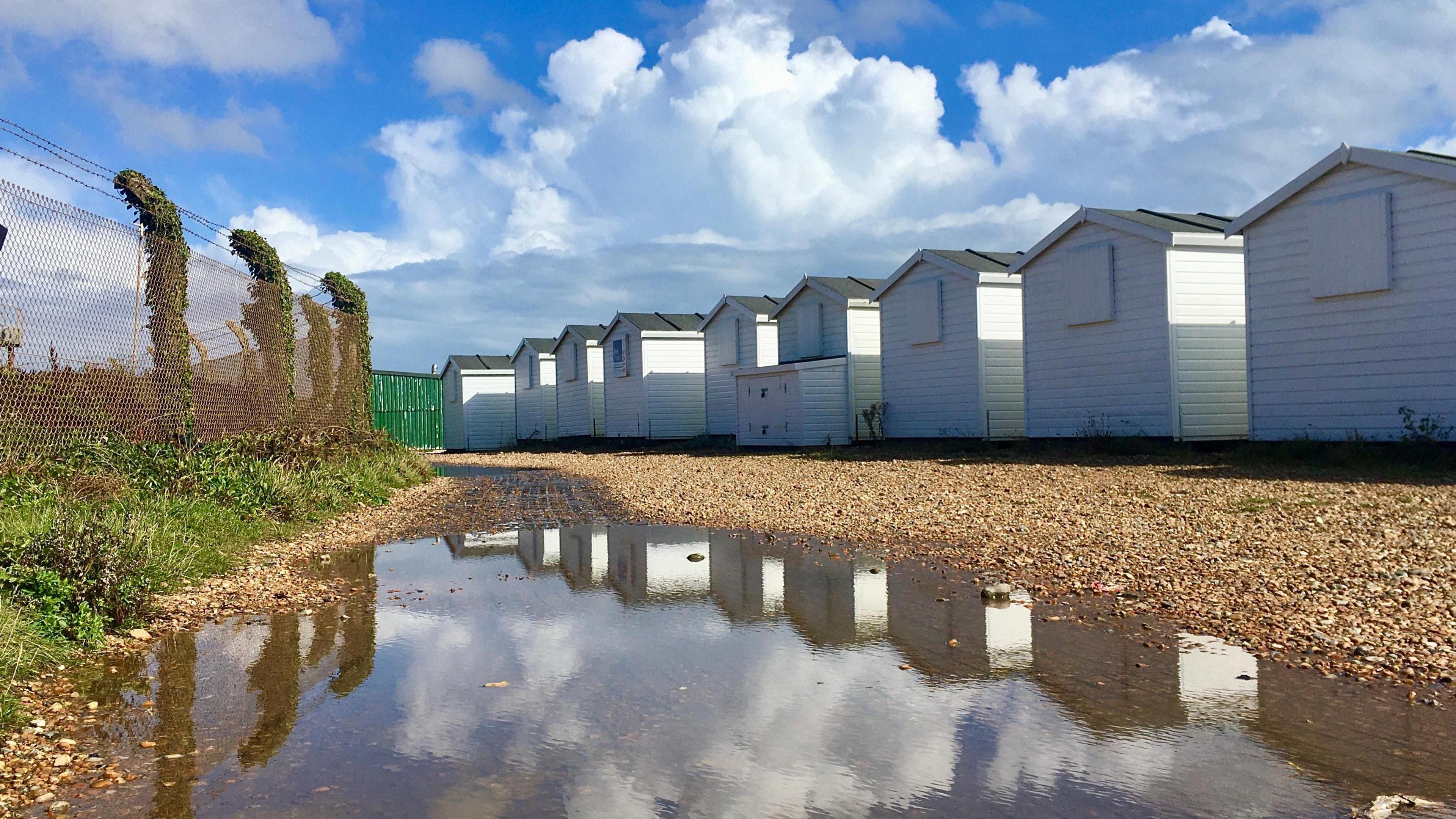 Image source, BBC Weather Watchers / John G
Parts of southern England have already seen one and a half times their typical September rainfall
The forecast for this week remains very unsettled.
After a calmer Tuesday with sunshine for many, Wednesday is expected to bring heavy rain in many areas.
Winds will also strengthen during midweek, particularly in the north of the UK with the chance of gales in northern Scotland by Thursday.
There is considerable uncertainty about exactly how this weather system will develop.
So while it does not currently look likely that this will be a named storm, it is worth staying in touch with the details on the BBC Weather website and app.
Warmer weather could briefly develop at the end of the week, especially in England and Wales, with possible highs of 24C (75F) in the south-east on Friday.
Although northerly winds are expected to develop over the weekend bringing a return of cooler conditions - and probably more rain.
Some computer models do suggest a chance of higher pressure and drier weather towards the end of the month but this is by no means certain.
As we moved deeper into autumn you can keep an eye on the longer-term weather prospects with our monthly outlook.


 English (US) ·