.png)
 1 week ago
9
1 week ago
9
Winter officially begins on 1 December but Thursday has bucked the trend of colder weather with much milder conditions.
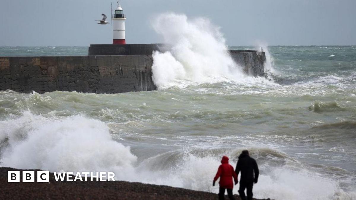
But this switch is accompanied by unsettled weather with Met Office yellow weather warnings for strong winds into Friday.
And it will stay changeable into the weekend with heavy rain and strong winds across England and Wales.
It is also likely to turn colder again with the threat of snow and 'frost days'.
Temperatures on Thursday morning were up to 17C higher than those on Wednesday morning.
And through the day they will be a good 5 or 6C above average for the end of November.
However, the milder air - being transported all the way from the Azores - is driven by a deep area of low pressure to the north of the United Kingdom.
This brings strong winds, especially across the north and west of Scotland.
A Met Office yellow warning for wind here is valid from 16:00 GMT Thursday to 11:00 GMT Friday.
Wind gusts of 60-70 mph are likely, with more exposed places perhaps seeing gusts up to 80mph.
This is likely to bring some disruption, particularly to ferry services in and around the Northern and Western Isles.
Tree branches may come down and there is a risk of some power cuts in some communities.
The strong winds will eventually subside later on Friday morning.
On Saturday a developing weather system will sweep across England and Wales bringing heavy rain and the possibility of strengthening winds.
There are still uncertainties with the detail as there are differences in some of the weather computer models on the exact track and development of this system.
Heavy rain though is likely to persist around eastern England in particular.
And a strong north to northeasterly wind will develop later on Saturday into Sunday, especially in eastern England where gusts of up to 50-60mph are possible.
While the wind won't be as strong elsewhere across the UK, the resulting northerly airflow will bring colder conditions again.
Maximum temperatures on Sunday will only be around 3-9C.
But, in Scotland the temperature for some may not rise above freezing - called a 'frost day'.
There will also be some wintry showers coming into the north and east of Scotland.
Further - more temporary - snow will fall on Monday in the Highlands as rain spreads in across the UK with milder prevailing southwesterly winds.
After the hottest summer on record for the UK along with one of driest springs, droughts with hosepipe bans were declared in many regions.
The National Drought Group met at the end of October where the Environment Agency suggested that England needs at least 100% of average rainfall up to the end of March to largely recover from drought.
The good news is that recent months have been pretty wet with data from the Met Office Hadley Centre showing that up to the 25 November, most of the UK has had near to above average rainfall for autumn.
On Thursday, Yorkshire Water said that the current hosepipe ban is expected to end "within the next few weeks" and earlier than initially thought as there has been plenty of rain.
In September the whole of the north-east England area, which covers Yorkshire, had 152% of its normal rainfall with 90% falling in October. Up to the 25 November there has already been 145% of normal rain.
A spokesperson from Yorkshire Water said reservoir levels were recovering well, now standing at 84.6% full, up from 80.5% last week.
Meanwhile, Hull aquifer levels were at 49.4% - up from 46.6%.
Helen Wakeham, chair of the National Drought Group said "recent rain is very welcome, but it needs to be sustained over the next six months...to fill up our rivers, reservoirs and groundwater levels".


 English (US) ·